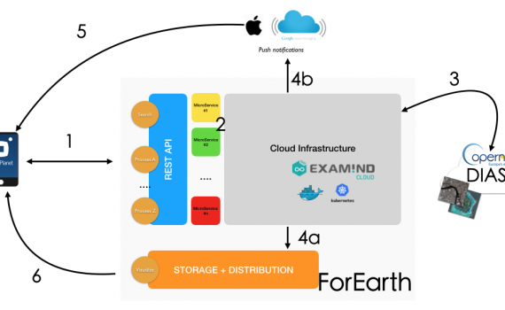
We’re thankful to Marc Gorman who highly contributed to the obtainment of the ForEarth project and will not have the opportunity to see the outcome. The European Spatial Agency (ESA) launch the initiative: EO Science for Society with the aim to enhance Copernicus data by producing EO applications in responses […]
Yearly archives: 2018
4 posts
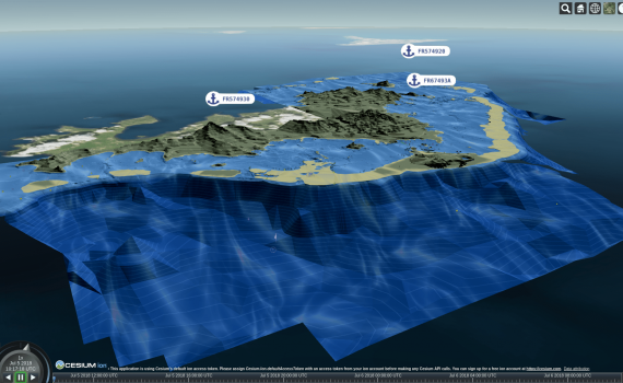
Before we start here is a first screenshot to open your appetite and demonstrate what can be done with 3D Tiles and 2D S-57 marine navigation data. Augmented Reality Marine Chart produced by Examind Server Specification status The 3D Tiles format has been around for a few years as part […]
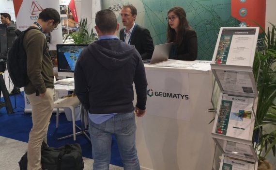
A ponctuated June month at Geomatys Little present on the shows in recent years, Geomatys has decided to boost its communication. The goal? Promote the company and its Examind software suite. Geospatial data processing software that integrates easily into your information systems. Already used by major companies (Airbus DS, Naval […]

The GDAL/Proj.4 community has raised $142,000 for improving the map projection library behind major Open Source geospatial softwares. The issues to be fixed require an architectural change. Proj.4 is moving away from the early-binding approach (where WGS 84 is used as a pivot system) to a late-binding approach (with no fixed pivot system and […]